An Australian team of tech enthusiasts has taken on the challenge to offer another option when it comes to disseminating serious information such as in an emergency.
The question asked was, ‘Is there an alternative that offers emergency managers an exclusive platform to curate serious information such as emergency alerts?’
Considering this, it was concluded that people still look to local websites for information relevant to them. Relevant because information disseminated by local managers who are familiar and most likely to work for and live in the community carry a lot of credibility. This is particularly relevant because these same managers are more likely to be trusted and can distribute valid and timely information.
The view is that the local website is still the ‘original’ source of truth when it comes to information for a community. Yet community websites are not consistently displaying or curating a dedicated area for current alerts, whether it be for warnings, incidents and other important notifications. In the main, this information is being posted elsewhere and tweeted and is easily lost among perhaps more trivial content. This requires readers (if they see it) to figure out what is relevant and important.
An alternative is a web-based solution that offers an easy way of creating a map-based Common Alerting Protocol1 alert. Alerts are accessible via a unique map and alert-list webpage as well as a mobile app. There is no need for people to register on the system. Users are completely anonymous, but can access all the information. The system devised by the UgoRound team allows community websites to integrate a dedicated and interactive web-based alert map. The map is location relevant and alerts are visibly relatable to that community.
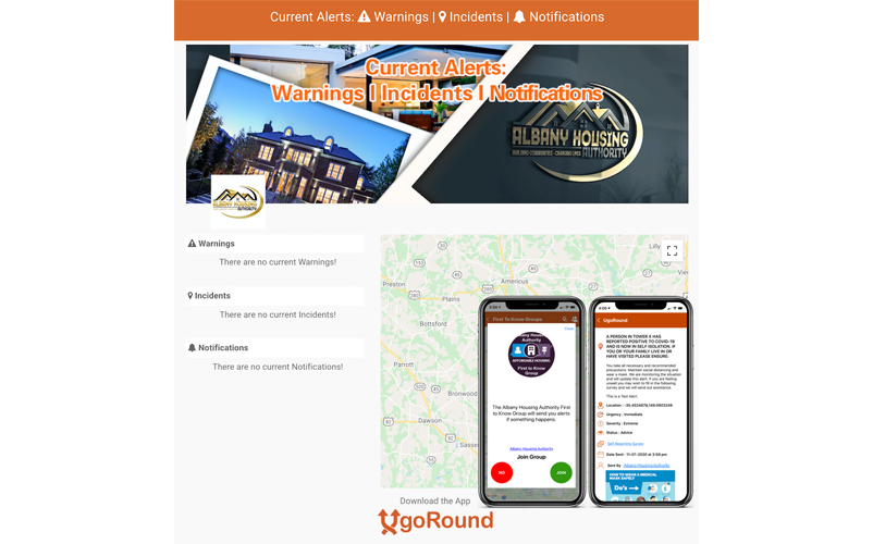
This decentralised approach to community alerts has been finding success in the USA. For example, the Albany Housing Authority in Georgia caters to a community of around 4000 people. The Authority was trying to distribute COVID-19-related information and was struggling to find a way to reach people so that they could access information, understand the seriousness and act accordingly.
The geo-alerting platform sends alerts to devices of people in affected areas.
The Authority adopted the alert map and people had access to a dedicated and current alert map page on the Authority’s website. In addition, users could download the UgoRound app and join the Authority’s First to Know group.
In Australia and New Zealand, this system is now available to all communities as well as emergency services organisations. This is a decentralised and whole-of-community approach to distribute critical information that can augment and also provide an alternative to SMS and social media channels.